Utah Braces for Tropical Moisture, Potential for Showers and Flash Flooding
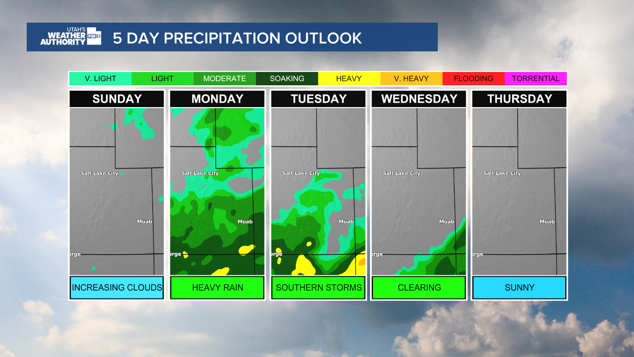
Tropical moisture is forecast to arrive in Utah, bringing increasing chances of scattered showers and thunderstorms across the state starting Sunday and intensifying on Monday. The heaviest rainfall is expected Monday and Tuesday, particularly in southern and eastern Utah, with…
 Salt Lake City, UT, September 27, 2026 —
Utah is forecast to experience a significant shift in weather patterns as tropical moisture is expected to arrive over the weekend, bringing increasing chances of scattered showers and thunderstorms. The weather system is predicted to intensify on Monday, with the heaviest rainfall anticipated on Monday and Tuesday.
The forecast indicates a moderate risk of flash flooding, particularly in the southern and eastern regions of Utah. Residents and authorities are advised to monitor weather updates closely as the situation develops.
Alongside the increased precipitation, cooler temperatures are also anticipated across the state during this period. This shift follows a pattern that is expected to bring drier weather back to Utah by the middle of the week.
Specific details regarding the exact timing and intensity of rainfall, as well as precise temperature drops, will become clearer as the forecast evolves. The National Weather Service typically provides detailed advisories for areas at risk of flash flooding.
The arrival of tropical moisture is a notable change from typical weather patterns, often bringing substantial rainfall that can impact local landscapes and infrastructure. Authorities are expected to issue relevant advisories to the public as the event approaches.
The duration of this wetter and cooler period is expected to be limited, with a return to drier conditions projected for midweek. Further updates will be provided as weather patterns become more defined.
Story summarized from the original created by Utah’s Weather Authority on www.fox13now.com, see more information here.
Media gallery